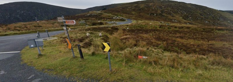
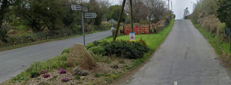
For each of the climbs a record of the strava/mapmyride/activity file or link is required or as an alternative a photo from both the start location of the climb and also from the top of the gap. We have included a GPS reference for the tops of each of the Gaps as well as pictures showing the tops. Road numbers have been included where they exist… these are mountain roads so you can’t expect them all to be numbered!
In each of the descriptions we have included a GPS reference to indicate the top of the climbs. Below each of the descriptions is a link to google maps which will open the route from the start location to the top of the climb. Alternate routes, where they exist, are shown in grey. Which you pick is entirely up to you.
Please send your evidence (strava links etc) to david.ronanscc@gmail.com or on whatsapp: Dave Ronan The Sally Gap – R759/Old Military Road (GPS: 53.1377529N 6.3119827W)
The Sally Gap

The Sally Gap – R759/Old Military Road (GPS: 53.1377529N 6.3119827W)
The first of the Gaps is the Sally Gap and it has a special place in the challenge as it has to be completed 4 times.
Sally Gap from Enniskerry
This is a somewhat more direct route to the top and starting in Enniskerry there are two possible options to get to the top: either up the main road to Glencree or alternatively over to Powerscourt waterfall and then up the other side of the valley past the Liam Horner Memorial to the top.
Sally Gap from Enniskerry – Google Maps Route
Sally Gap from Manor Kilbride
Starting in Manor Kilbride, and how you get there is up to you, this ascent takes you up from The west side of the Sally gap up past the Coronation Plantation and all the way to the crossroads at the top.
Sally Gap from Manor Kilbride – Google Maps Route
Sally Gap from Roundwood
There are multiple routes from Roundwood to the top of the Sally Gap, all of which go over Luggala. It’s a testing bit of riding with a lovely sting in the tail but the views on a good day are cracking!
Sally Gap from Roundwood – Google Maps Route
Sally Gap from Laragh via Glenmacnass
This is the longest route to the top of the Sally Gap but starting in Laragh always puts you in a good mood. Head up past Glenmacnass and continue along the Military Road all the way to the Crossroads at the Sally Gap.
Sally Gap from Laragh – Google Maps Route
The Wicklow Gap

The Wicklow Gap – R756 (GPS: 53.0418105N 6.3979355W)
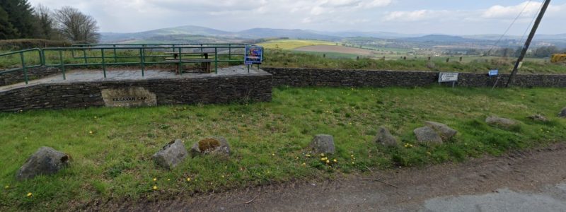
For the Wicklow Gap, and a bit of variety there are two start options, beginning either in Laragh or Hollywood and crossing the top at the entrance to Turlough Hill (pictured above). Like all the gaps this is a challenging climb from either side and choosing a route to get you home again is well advised.
Wicklow Gap from Laragh – Google Maps Route
Wicklow Gap from Hollywood – Google Maps Route
The Old Wicklow Gap

The Old Wicklow Gap R747 (GPS: 52.7636467N 6.3597169W)
The Old Wicklow Gap can be approached from three different start locations and the choice is yours as to which you pick. You can choose from Aughrim, Tinahely or Hollyfort. This one is in county Wexford!
Old Wicklow Gap from Hollyfort – Google Maps Route
Old Wicklow Gap from Aughrim – Google Maps Route
Old Wicklow Gap from Tinahely – Google Maps Route
The Kilcavan Gap

Kilcavan Gap – R747 (GPS: 52.7381262N 6.4745204W)
The Kilcavan Gap is the most southerly of the Gaps and depending on the route you take you may pass through county Wexford. Again there are two option to get to the top approaching from either Carnew or Aughrim. For those who know the route this is on the Ardattin 200.
Kilcavan Gap from Carnew – Google Maps Route
Kilcavan Gap from Aughrim – Google Maps Route
Best of luck to everyone who has a go at some, or all, of these climbs. Some of the climbs will take a bit of planning to get to and others will take some planning to get back from but all are really nice climbs and well worth a day out!
Comments are closed